Quick Facts
- Rescue Success: As of 2024, at least 750 people worldwide have been rescued as a direct result of drone technology.
- Search Efficiency: Search and rescue teams using drones locate missing persons in complex terrains an average of 191 seconds faster than traditional ground-based protocols.
- Market Growth: The global search and rescue drone market is projected to grow from $3.76 billion in 2024 to $13.49 billion by 2034.
- Extreme Durability: Modern rescue units feature IP55 weather resistance, allowing operation in temperatures ranging from -4°F to 122°F.
- Thermal Precision: Industry-standard 640x512 radiometric sensors allow teams to detect 37°C thermal signatures from hundreds of feet in the air.
- High Altitude Performance: Specialized UAVs are now capable of maintaining flight endurance at altitudes exceeding 15,000 feet.
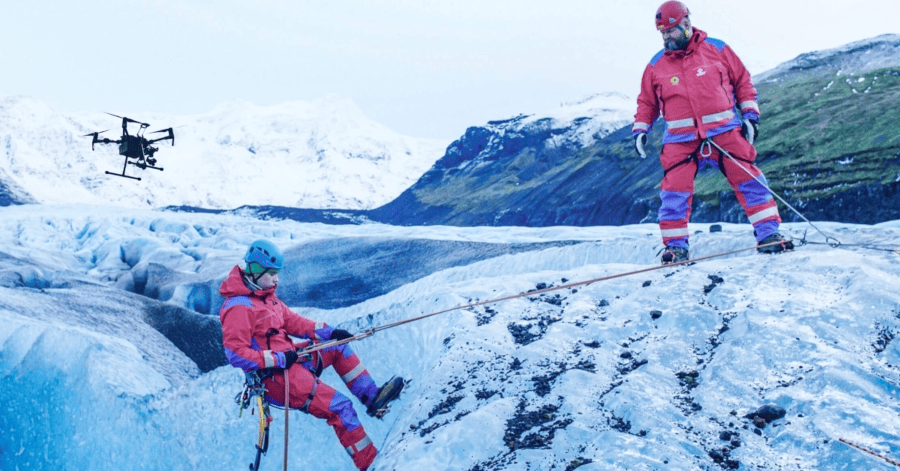
Mountain rescue drones enhance hiker safety by providing rapid situational awareness and emergency supply delivery. Equipped with thermal sensors, these UAVs can locate stranded individuals in dense forests or at night, allowing responders to coordinate ground teams more efficiently before physical contact is possible. By utilizing uav search and rescue technology, agencies can offer a critical lifeline in rugged alpine environments while primary rescue teams are still en route.
As hiking popularity surges globally, the risks associated with backcountry exploration have increased proportionally. From sudden weather shifts to navigational errors, the margin for error in the wilderness remains slim. However, the integration of mountain rescue drones is fundamentally shifting the odds in favor of the lost and injured. These advanced tools are no longer just flying cameras; they are sophisticated, life-saving platforms that act as the first line of defense in the world's most dangerous terrains. When looking for the best search and rescue drones for wilderness hiking safety, responders now prioritize thermal resolution, flight stability, and the ability to operate in thin, high-altitude air.
The Science of Search: Thermal Imaging and Night Operations
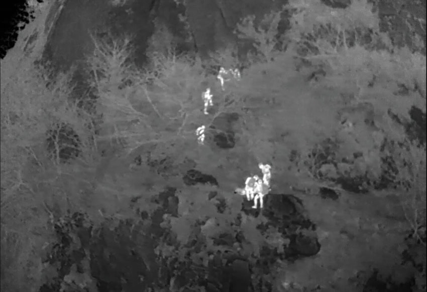
The most critical window in any search operation is the first few hours, especially as temperatures drop after sunset. Traditional ground searches are often slowed by treacherous terrain, while helicopters are limited by high operational costs and noise that can drown out a victim's cries for help. This is where mountain rescue drones with thermal imaging for night searches have become indispensable.
Modern search drones utilize 640x512 radiometric sensors that serve a very specific biological purpose: filtering through environmental noise to find the 37°C thermal signatures of a human body. In a cold mountain environment, a stranded hiker glows brightly against the cool background of rocks and trees. This thermal sensor technology allows operators to cover miles of terrain in minutes, identifying heat blooms that are invisible to the naked eye.
Beyond simple heat detection, uav search and rescue technology has evolved to include multispectral imaging. This allows for better forest penetration, helping teams see through light leaf cover or dense brush where a person might be lying motionless. The efficiency is backed by rigorous testing; randomized trials show that drone-assisted teams find their targets significantly faster than those relying solely on ground boots. For a hiker suffering from hypothermia, those saved minutes are often the difference between life and death.
From Scouting to Survival: Active Intervention via Payload Delivery
The role of the drone has shifted from passive observer to active participant. Finding a hiker is only half the battle; the next challenge is keeping them alive until ground teams can reach them. Emergency supply delivery drones are now being used to bridge this gap. In technical terrain where a rescue climber might take three hours to reach a victim, a drone can arrive in three minutes.
Drones for emergency supply delivery to stranded hikers are equipped with specialized payload delivery mechanisms. These systems allow operators to drop critical items without needing to land in hazardous spots. For example, during a high-profile rescue on Camelback Mountain, responders stayed in constant contact with a stranded party by using a drone to fly a cellular phone and a power bank directly to their ledge. This allowed the victims to provide real-time updates on their physical condition and location, which guided the helicopter extraction team with surgical precision.
Survival Payload Checklist
When emergency supply delivery drones are deployed, they typically carry a curated kit designed to stabilize a victim. Common payloads include:
- Compact thermal blankets for hypothermia prevention
- Two-way communication devices or satellite messengers
- High-calorie glucose gels and hydration sachets
- First aid kits including trauma shears and antiseptic
- High-intensity LED beacons to mark the location for ground teams
Drone route scouting in mountains also plays a vital role here. Before a rescue team enters a dangerous icefall or avalanche zone, a drone can perform high-speed reconnaissance to identify the safest path of approach. This use of first aid kit delivery via drones in remote hiking areas ensures that while the drone provides immediate relief, the human rescuers are not walking blindly into a secondary emergency.
Built for the Wild: Technical Demands of High-Altitude SAR
Not just any commercial drone can survive the rigors of mountain rescue. The environment demands high altitude drone performance for mountain rescue missions, where thin air reduces lift and extreme winds test motor stability. High-altitude flight endurance is the primary metric for success; a drone must be able to hover and maneuver at 15,000 feet or higher without motor failure.
Durability is another non-negotiable factor. An IP55 weather resistance rating is the gold standard, ensuring the aircraft can withstand rain, dust, and snow without short-circuiting. As rescue teams often operate far from base camp, tactical BVLOS (Beyond Visual Line of Sight) capabilities are essential. With transmission ranges now reaching up to 15km, a pilot can remain in a safe, heated vehicle while the drone navigates deep into a canyon.
Hardware Comparison: Portability vs. Power
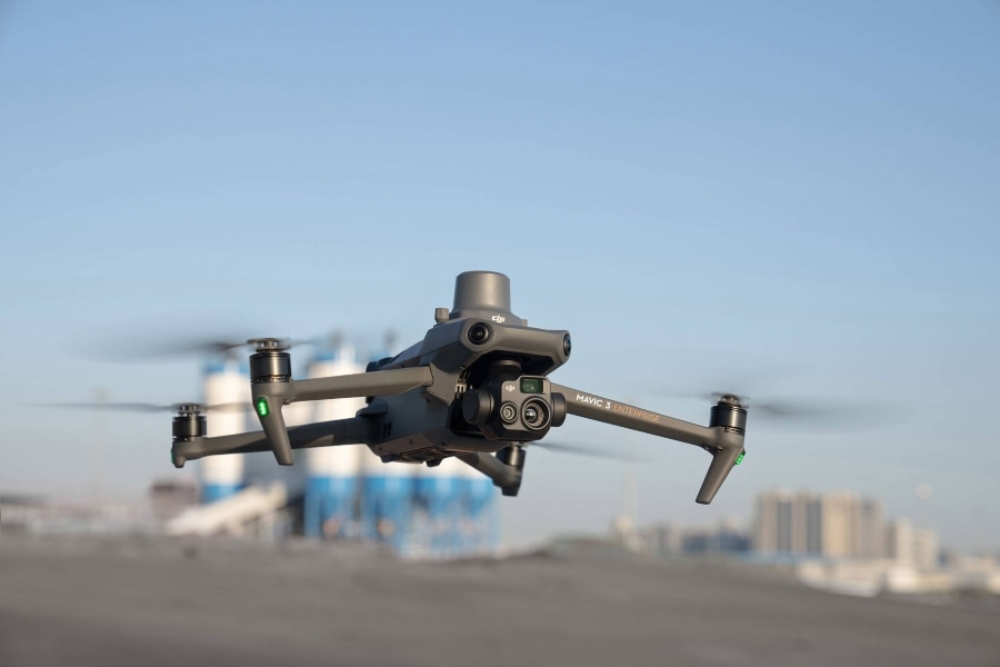
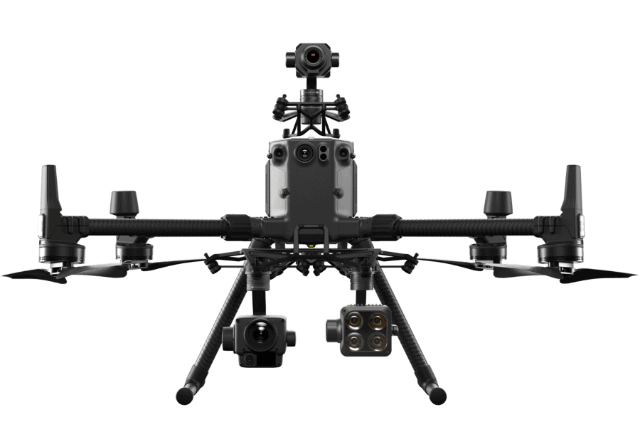
| Feature | DJI Mavic 3T (Portable) | DJI Matrice 350 RTK (Enterprise) |
|---|---|---|
| Weight | 920g | ~9kg |
| Deployment Time | Under 1 minute | 3-5 minutes |
| Wind Resistance | 12 m/s | 12 m/s |
| Payload Capacity | Fixed sensors | Up to 2.7kg (Multi-payload) |
| Best For | Rapid response, hiker-accessible trails | Long-range search, heavy supply delivery |
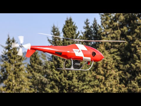
Agencies like Swiss Alpine Rescue have standardized drone use to navigate terrain that is too dangerous for helicopters or ground crews. Their reliance on these systems highlights the transition from drone use being a "luxury" to becoming a mandatory component of the search and rescue toolkit.
The Future Horizon: AI Detection and Drone as First Responder (DFR)
The next evolution of hiking safety lies in automation. The Drone as First Responder (DFR) model is currently being piloted in several regions where drones are stationed in autonomous nests throughout high-traffic hiking corridors. The moment an emergency call is received, the drone launches automatically, flying to the GPS coordinates provided by the caller’s phone or the cell tower ping.
Furthermore, autonomous flight paths and AI-powered victim detection are reducing the cognitive load on pilots. Instead of a human operator squinting at a screen to find a person, AI algorithms scan the video feed in real-time, highlighting anomalies that match human shapes or colors that stand out in nature. This technology is particularly useful in avalanche zones, where drone swarms may eventually be used to cover large fields of debris in seconds, using ground-penetrating sensors to find buried victims.
As the global search and rescue drone market continues its rapid expansion toward a $13.49 billion valuation, we can expect the technology to become even more pervasive. For the average hiker, this means the wilderness is becoming a little less lonely. Even in the most remote corners of the backcountry, an eye in the sky might be your best chance at coming home.
FAQ
How are drones used in mountain search and rescue?
Search teams use drones to rapidly scan large areas of difficult terrain using high-resolution cameras and thermal sensors. They provide situational awareness to ground teams, identify hazards like unstable snow or cliffs, and can deliver emergency supplies like radios and first aid kits to individuals who are stranded in inaccessible locations.
Can drones fly at high altitudes for rescue operations?
Yes, specialized enterprise-grade drones are designed with high-altitude propellers and powerful motors that allow them to operate effectively at elevations over 15,000 feet. While the thin air reduces battery efficiency, these UAVs are engineered to maintain stability and control in mountain environments where traditional aircraft might struggle.
What type of drones are best for search and rescue?
The best drones for search and rescue typically feature radiometric thermal sensors, high-zoom visual cameras, and long-range transmission systems. Portability is also key for teams that need to hike into a base camp, making models like the Mavic 3T popular for rapid response, while larger platforms like the Matrice series are preferred for heavy payload delivery.
Can rescue drones operate in extreme weather conditions?
Drones with an IP55 or higher ingress protection rating can operate in rain, snow, and dusty conditions. They are built to withstand high wind speeds and temperatures ranging from well below freezing to extreme heat, though battery life is often reduced in very cold alpine environments.
How do thermal drones help find missing people in the mountains?
Thermal drones detect heat signatures rather than visual light. They are specifically tuned to pick up the 37°C temperature of a human body, which appears as a bright hotspot against the much colder ambient temperature of the mountain. This allows rescuers to find people at night, under light forest cover, or in foggy conditions where they would otherwise be invisible.